- Home
- Malta Island
- How Big Is Malta
How big is Malta?
Malta’s Size, Dimensions and Comparisons Explained
How big is Malta? Malta has a total area of approximately 316 square kilometres (122 square miles), which includes the main islands of Malta, Gozo, Comino, and several smaller islands. The main island of Malta covers about 245.7 square kilometres (95 square miles) and stretches roughly 28 kilometres (17 miles) in length and 14.5 kilometres (9 miles) in width.
Despite its small size on a map, travel times in Malta can be longer than anticipated. Factors such as traffic, bus routes, and the road network can make journeys between towns take more time.
 Aerial View of Malta From a Plane
✍️ Written by Albert and Benjamin Magro, Malta locals sharing practical advice based on living on and exploring the islands.
Malta’s Size, Comparisons and Travel Distances
- Malta’s Size and Dimensions
- How Big Is the Island of Gozo?
- Typical Distances and Travel Times in Malta
- How Big Is Malta Compared to Other Places?
- What Malta’s Size Means for Your Trip
- Frequently Asked Questions About Malta’s Size
Malta’s Size and Dimensions
Malta is compact, with towns, beaches and attractions relatively close together. However, traffic and Malta’s road network can make short distances take longer than visitors might expect.
 How Big Is Malta? Size and Dimensions
Malta at a Glance
- Entire Maltese archipelago: Around 316 square kilometres (122 square miles)
- Length of the whole archipelago: Around 45 kilometres (27 miles)
- Main island of Malta: About 245.7 square kilometres (95 square miles)
- Length of the main island: Around 28 kilometres (17 miles)
- Width of the main island: Around 14.5 kilometres (9 miles)
- Shoreline of the main island: Around 196.8 kilometres (122 miles)
Malta is the largest island in the archipelago, which also includes Gozo, Comino and several smaller islands.
Local Travel Tip
Malta's small size can be deceptive when planning your travels. A destination may appear close on the map, but factors like traffic, road layouts, and bus routes can make travel between areas take longer than you expect.
When selecting your accommodation, focus on the locations you plan to visit most frequently rather than just the distance shown on the map.
How Big Is the Island of Gozo
Gozo, known as Għawdex in Maltese, is the second-largest island in the Maltese archipelago. It lies around 8 kilometres (5 miles) northwest of the main island of Malta.
Gozo At a Glance
- Total area: Around 67.1 square kilometres (25.9 square miles)
- Length: Around 14.5 kilometres (9 miles)
- Width: Around 7.2 kilometres (4.5 miles)
- Shoreline: Around 56 kilometres (35 miles)
Gozo is much smaller and quieter than the main island of Malta. For a familiar comparison, it is slightly larger than Manhattan by land area.
Comino, the third-largest island in the archipelago, covers around 3.5 square kilometres (1.4 square miles).
 Mġarr Harbour and Ferry in Gozo
How to Get to Gozo
The regular passenger and vehicle ferry travels between Ċirkewwa in northern Malta and Mġarr Harbour in Gozo. The crossing takes approximately 25 minutes, although the full journey will be longer when travelling to Ċirkewwa from the airport or another part of Malta.
Once in Gozo, distances are generally short. Victoria lies near the centre of the island and provides convenient road connections to its villages, beaches and attractions.
Typical Distances and Travel Times in Malta
The distances and travel times listed are approximate. Journey times may vary significantly due to traffic, roadworks, the time of day, and your precise starting point.
From Malta International Airport
Approximate road distances and driving times include:
- Valletta: 10.3 kilometres (around 17 to 20 minutes)
- St Julian’s and Sliema: Around 12 kilometres (approximately 20 minutes)
- Mdina and Rabat: 13.4 kilometres (around 22 minutes)
- Marsaxlokk: Around 8 kilometres (approximately 15 minutes)
- Buġibba, Qawra and St Paul’s Bay: Around 20 kilometres (approximately 35 minutes)
Journeys to Gozo and Comino require additional travel by ferry or boat, so the total journey depends on your departure point, waiting time and the service you use.
From Valletta
- Malta International Airport: 10.3 kilometres (around 20 minutes)
- St Julian’s and Sliema: Around 7.5 kilometres (approximately 15 minutes)
- Mdina and Rabat: Around 13.6 kilometres (approximately 20 minutes)
- Buġibba, Qawra and St Paul’s Bay: Around 18.2 kilometres (approximately 30 minutes)
From St Julian’s, Sliema and Gżira
St Julian’s, Sliema and Gżira form a largely continuous urban area along Malta’s northeastern coast. The distance and travel time will depend on your starting point.
- Malta International Airport: Around 12 kilometres (approximately 19 minutes)
- Valletta: Around 9.2 kilometres (approximately 15 minutes)
- Mdina and Rabat: Around 14 kilometres (approximately 25 minutes)
- Buġibba: Around 12.8 kilometres (approximately 23 minutes)
 Spinola Bay Harbour in St Julian’s
From St Paul’s Bay, Buġibba and Qawra
St. Paul’s Bay, Buġibba, and Qawra stretch along the northern coastline, so the exact distance will depend on your starting point.
- Malta International Airport: Around 20 kilometres (approximately 35 minutes)
- St Julian’s and Sliema: Around 12.8 kilometres (approximately 23 minutes)
- Valletta: Around 18.2 kilometres (approximately 30 minutes)
- Mdina and Rabat: Around 9.6 kilometres (approximately 20 minutes)
From Mdina & Rabat
Mdina and Rabat are neighbouring locations in central Malta, so travel times are typically similar from either area.
- Malta International Airport: Around 13.4 kilometres (approximately 22 minutes)
- Buġibba, Qawra and St Paul’s Bay: Around 9.6 kilometres (approximately 20 minutes)
- St Julian’s and Sliema: Around 14 kilometres (approximately 25 minutes)
- Valletta: Around 13.6 kilometres (approximately 20 minutes)
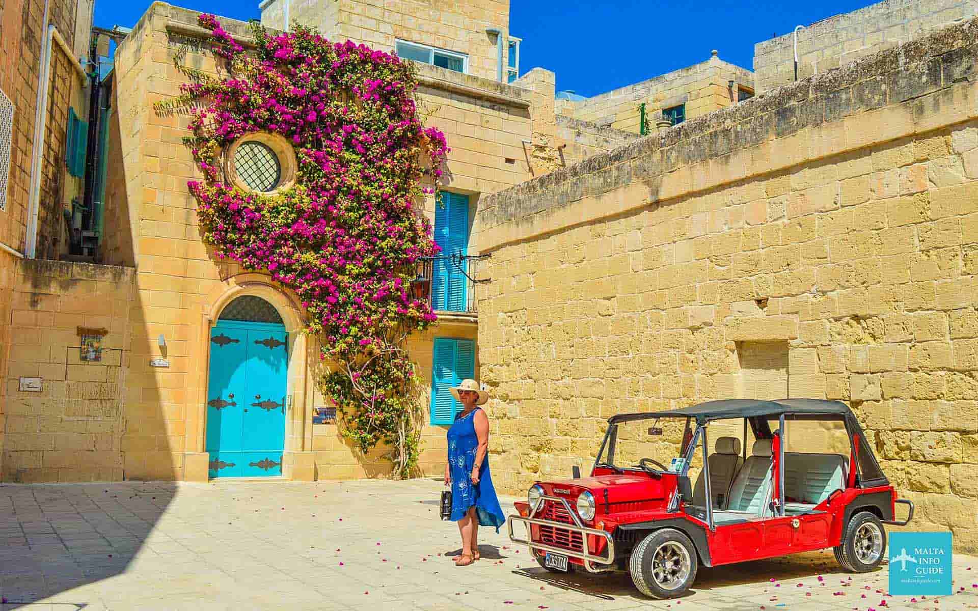 Traditional Street in Mdina, Malta
How Big Is Malta Compared To Other Places?
The Maltese archipelago covers approximately 316 square kilometres (or 122 square miles). The comparisons provided below refer to this total area, rather than just the size of the main island. By comparing Malta to familiar countries, islands, and cities, its compact size can be better understood.
| Place | Approximate Area | Comparison With Malta |
|---|---|---|
| Malta | 316 square kilometres | The total area of the Maltese archipelago, used as the reference for these comparisons. |
| Ibiza, Spain | 572 square kilometres | Ibiza is approximately 1.8 times the size of Malta. |
| Cyprus | 9,251 square kilometres | Cyprus is approximately 29.3 times the size of Malta. |
| Antigua | 281 square kilometres | Malta is approximately 1.1 times the size of Antigua. |
| Maldives | Around 300 square kilometres of land | Malta is approximately 1.05 times the land area of the Maldives. |
| Mallorca, Spain | Around 3,640 square kilometres | Mallorca is approximately 11.5 times the size of Malta. |
| New York City | Around 784 square kilometres of land | New York City has approximately 2.5 times Malta’s land area. |
| Paris, France | Around 105.4 square kilometres | Malta is approximately 3 times the size of the City of Paris. |
| Rome, Italy | Around 1,285 square kilometres | Rome is approximately 4.1 times the size of Malta. |
| London, United Kingdom | Around 1,572 square kilometres | Greater London is approximately 5 times the size of Malta. |
| United Kingdom | Around 243,610 square kilometres | The United Kingdom is approximately 771 times the size of Malta. |
| Isle of Wight, United Kingdom | Around 380 square kilometres | The Isle of Wight is approximately 1.2 times the size of Malta. |
Note: These figures are approximate. Malta’s figure refers to the whole Maltese archipelago, while city and island boundaries may be defined differently depending on the source.
What Malta’s Size Means for Your Trip
Malta's small size allows most visitors to stay in one area and explore the island through day trips, rather than frequently changing accommodations.
However, short distances do not always equate to short travel times. Factors such as traffic, bus routes, and your accommodation's location can significantly affect your travel experience, especially during busy periods.
When selecting where to stay, consider the places you plan to visit most often, rather than judging the journey solely by distance.
Booking your trip to Malta
Malta’s compact size makes it possible to explore many parts of the island from one accommodation base. Your choice of area will still affect journey times, particularly if you plan to rely on buses.
Getting to Malta
Most international visitors arrive through Malta International Airport, the country’s only airport.
Where to Stay
Choose an area that is convenient for the places you intend to visit most often. Our guide to the best places to stay in Malta explains the main areas and the types of travellers they suit.
What to Do in Malta
Despite its small size, Malta offers historic cities, beaches, villages, museums and coastal attractions. See our guide to the best things to do in Malta for ideas and inspiration.
Frequently Asked Questions About Malta’s Size
Is Gozo In Malta?
Is Gozo In Malta?
Yes. Gozo is a separate island, but it forms part of the country of Malta and the Maltese archipelago. It lies northwest of the main island and can be reached by ferry. It is located northwest of the main island of Malta and can be accessed by the Gozo ferry.
How many miles long is Malta?
How many miles long is Malta?
The main island of Malta is approximately 17 miles (28 kilometres) long and about 9 miles (14.5 kilometres) wide. The entire Maltese archipelago extends for around 27 miles (45 kilometres).
How Long Does It Take to Drive Around Malta?
How Long Does It Take to Drive Around Malta?
There is no single road that circles the whole island. Driving from one end of Malta to the other may take around one hour in light traffic, but the journey can take considerably longer during busy periods.
A sightseeing drive around different parts of the island would normally take several hours, especially when stops are included.
Can You Walk Around Malta in a Day?
Can You Walk Around Malta in a Day?
No. Although Malta is small, walking around the entire island in one day is not realistic for most visitors. You can comfortably explore individual towns, coastal areas or sections of Malta on foot, but travelling between distant attractions usually requires buses, taxis or a rental car.

Disclaimer — We may earn a commission if you book via certain links on the website. No extra cost to you.
🎉 What’s On In Malta?
Updated for September • Local picks
Discover events, village feasts, fireworks, festivals and seasonal things to do this September.
📅 See What’s Happening This September ⛪ Malta Village Feasts 🌞 Things To Do In Malta 🗓️ Events By Month❤️ Enjoying Malta Info Guide?
If our free local guides made planning your Malta trip easier, you can say thanks with a small beer.
Written by two locals. Always free.

✈️ Planning your Malta trip?
✈️ Flights to Malta
Compare airlines and find the best prices today.
Check today’s cheapest flights →🏨 Hotels in Malta
Find available rooms, trusted stays and good locations for your Malta trip.
See available hotels this week →🚗 Car Rental in Malta
Compare prices, pick-up points and car options before you book.
Compare car rental prices →Planning London too?
Discover where to stay, what to do, and when to visit London.
Explore London Guide →Recent Articles


-
Christmas Pantos in Malta 2026/27 - Dates, Venues & Tickets
Sep 14, 26 12:07 PM
Find Christmas pantos in Malta and Gozo for 2026/27, with confirmed dates, venues, language, age guidance, booking status and official ticket links. -
Dog Friendly Beaches Malta & Gozo: 16 Official Locations
Sep 13, 26 04:09 AM
Find the 16 official dog friendly beaches in Malta and Gozo, plus the rules on where dogs can swim and what owners need to know before visiting. -
Xlendi Bay Gozo: Local Guide to Swimming, Beach & Tips
Sep 11, 26 03:26 PM
Local guide to Xlendi Bay in Gozo, with advice on swimming, the small beach, restaurants, parking, buses, summer crowds and who Xlendi suits best.