- Home
- Malta Island
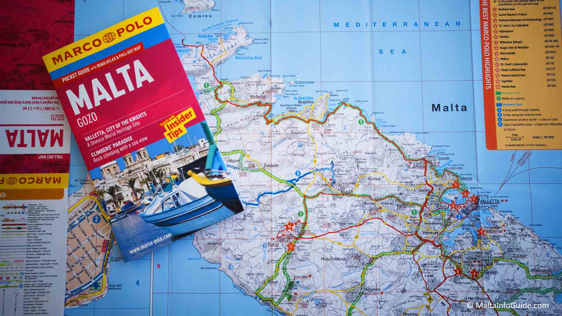
- Maps of Malta
Maps of Malta
A Selection Of Maps Of Malta For The Visitor
Maps of Malta can be your best friend to help you find your way around the islands.
Having a physical map is always handy to carry and find your way around until you get to the area where you will be living or visiting.
Today most maps are on personal mobile phones. Through Google Maps you find fast the locations you require; being historical locations, accommodation, restaurants, entertainment and shopping.
Disclaimer — We may earn a commission if you book via certain links on the website. No extra cost to you.
📹 Top 7 Best Places To Visit in Malta For 2025
Wondering which spots in Malta should be on your 2025 travel list? Join us on a journey across Malta as we highlight breathtaking views, cultural gems, and experiences you won’t want to miss. Subscribe to our YouTube channel for more content like this. (Sound ON 🔊)
You can get free maps as soon as you arrive at Malta International Airport. At the arrivals lounge there is the tourist office where you find maps, brochures and all that is happening around the islands.
If you are unable to visit this office or it is closed at the time of your arrival you can visit the Valletta office or the various offices spread across the islands.
Maps of Malta
Barely visible on the world map. So where is Malta? The islands of Malta are in the very centre of the Mediterranean sea, between Sicily and Africa.
- It is the smallest member of the European Union 28 member states.
- Consists of three main islands: Malta the largest, Gozo and Comino are inhabitied.
- The Maltese archipelago the smallest in the world.
- Population 493,559 (end of 2018); most densely populated with an area of just 316sq km on both islands.
- Malta is a promising diverse culture, commercial and administrative centre.
- Malta is a Republic with its parliament, the cabinet and judicial system.
- Climate Mediterranean, hot summers and mild winters.
- Two main languages Maltese and English.
- Malta is more than just a small island. Keep yourself busy, sandy beaches, nightlife and 7,000 years of history with UNESCO World Heritage sites.
What Can Google Map Do For You In Malta
Using Google maps gives you many opportunities to discover the island before coming and whilst you are here.
- If you are renting a car, you can see current traffic congestions in various colours. They are marked in three different colours, green (light), orange (medium) and red (heavy).
- You can see Malta in 3D street view, by placing a dummy in a street and walk around.
- See what amenities there are near your current location for example coffee shops, gas stations, hotels, restaurants and more.
- You can see all Malta Public transport bus stops, route numbers and destination of route.
The Island of Gozo Map
- Gozo the second largest island with abundant countryside with open spaces and peaceful.
- The capital city of Gozo is Rabat, also known as Victoria.
- The population is 31,000.
- The island can only be reached by ferry.
- The size of Gozo is 67 km square.
The Island of Comino Map | Malta Map
- Comino almost uninhabited is a popular destination for the popular Blue Lagoon day-trippers and hikers.
- There are only 3 people (2017) living on the island. They are all related.
- The island on has one hotel which is in operation during summer.
- Comino is a very popular destination during summer.
- Here you find the famous Blue Lagoon which is visited by thousands every year.
- There are boat tours that go to this island daily.
- The island size is of 3.5 km square.
Route Maps For Malta Public Transport
- Malta public transport is the only public transport on the island. Any visitors will find these maps handy as they show the routes in various colours for all the island.
- If a tourist wishes to use the public transport during their holiday these maps are a very fast indicator of which bus routes to take. You can identify the location you wish to go, identify the route numbers and see from where you can board the bus.
- On the map you will find all the interchanges around the islands,all the routes in different colours together with the route numbers and also very important landmarks such as the airport, hospital, ferry, beaches and places of interest.
- You can download the maps for Malta and Gozo by clicking here
- Today due to the use of mobiles it is easy to download the Public Transport app to know of bus departures and arrival times at the different bus stops across the islands.
Maps of Malta & Villages
If you are visiting the islands there are various available maps with important locations on the island. You can download or print for personal use only since they are the property of the Malta Tourist Authority.
These maps are in PDF format and you will require to have the Adobe Acrobat Reader to see the details and save a copy on your computer. You can also download them on your mobile phone for easy access when you come over for your holiday.
To download a map click the downwards arrow with a line under which is located top left of the map
Malta and Gozo in A3 or in A4 sizes.
The map shows a general view of the three main islands. All the town and village locations including their names and all the main roads connecting them.
The various symbols show all the tourist offices with their contact number, beaches, museums, hospital, prehistoric sites, blue flag beaches, free wi-fi locations, fortification towers and the Cruise Liner Terminal in Valletta.
Download the A3 Malta and Gozo map and A4 Malta and Gozo map.
Malta A3 size
This map is split in three different sections offering a street map for the Sliema, St. Julian's and Paceville area. Right top Valletta the capital city and bottom right St. Paul's Bay, Bugibba and Qawra.
Here you find a concentration of accommodation, attractions, shopping, restaurants and bars.
In particular the map of Valletta although small shows the Knights of St John auberges, cathedrals, churches, audio visual shows, museums, squares, access for pedestrians, car routes, pedestrian areas, lift at the Upper Barrakka Gardens and interesting locations to visit.
Download the Malta A3 size map
Mdina A4 size Map
The Mdina map has a of the places of interest and symbols showing the museums, cathedral, the recommended scenic views, tourist office location and ATM.
It proposes a pedestrian walk around the old capital. Also showing the approach from outside the main gate from Rabat with the various requirements of public transport, petrol stations, ATM and toilet facilities.
Download the Mdina Map.
Mellieha A4 size Map
Mellieha village is located in the north of the island with hotels and many rental holiday apartments. It is very popular and attracts many people to the longest sandy beach Ghadira Bay. This map is two sided, one side shows the village area and the other the north tip of the island with all the bays, hotels and ferry terminal.
Download Mellieha map.
Marsaxlokk A4 size
Marsaxlokk village with all its road names. If you intend going for some time it is good to keep a copy on your mobile where it shows the tourist office, the bank with an ATM, the sandy beach, pedestrian area where here you find the daily market and the numerous restaurants along the promenade. Toilets facilities and Wifi are located in the central area adjacent to the promenade.
Download Marsaxlokk map.
St. Paul's Bay - Bugibba and Qawra A4
The map of Bugibba and Qawra as they are all interconnected. This area has a variety of 2 to 4 star hotels with many rental apartments. The map gives symbol indications of the main facilities which you might require to use while there.
Important to visit the National Aquarium, The Oracle Casino, Classic Car museum, the perched sandy Beach, water park, various swimming areas and numerous restaurants and bars very popular with foreigners.
Download the St. Paul's, Bugibba and Qawra map.
The Three Villages
Attard, Lija and Balzan located in the central area all linked to each other. Accommodation in these areas are limited. The best in these areas are the gardens which form part of the official residence of Malta’s President which are open to the public. Numerous old houses with beautiful architecture line the old streets of the localities as they were inhabited by wealthy local families.
Download The Three Villages map.
Route Maps For Country Walks
- Free
walks you can do yourself with the use of a map.
- It is the best time for walks in the countryside as after the first rains the green tapestry across the countryside take shape after the long hot summer. The best time for walks is from mid-November until mid-May.
- Here are a maps to the list of country walks map you can enjoy.
In the link above you will find the following country walks:
- Walk 1 - Dingli - Fawwara - Wied iż-Żurrieq Walk
- Walk 2 - Mdina Walk - Mdina and Dingli.
- Walk 3 - Bahrija walk - The area around Bahrija village
- Walk 4 - Watch Tower walk - Marfa.
- Walk 5 - Hal Milieri walk - Qrendi, Mqaba and Zurrieq.
- Walk 6 - Tas-Silg Walk - Marsaskala and Marsaxlokk.
- Walk 7 - Tal-Maqluba walk - Maqluba, Siggiewi and Grendi.
- Walk 8 - Girgenti walk - Buskett and Siggiewi
- Walk 9 - Windmill walk - Zurrieq and Safi
What To Do In Malta
Important Locations around the islands
- The island of Gozo
- The island of Comino
- Malta International Airport
- Cirkewwa Ferry Terminal
- Mater Dei Hospital, Msida
- Boffa Hospital, Floriana
- Sir Anthony Mamo Oncology Hospital
- Valletta main bus terminus
- Qormi Bus interchange
- Pembroke Park and Ride bus terminus
- Cruise Liner Terminal, Valletta
- Virtu Ferries Passenger Terminal
- Ferry boat from Sliema to Valletta
- Ferry boat from Valletta to 3 Cities
- Police Headquarters, Floriana
- Law Courts, Valletta
- Identity Malta (Non-EU Nationals only), Msida
- Identity Malta, Blata L'Bajda
- VAT Department, Msida
- Commissioner of Revenue, Floriana
- Passport Office, Valletta
- Transport Malta, Lija
Shopping Centres
- Pavi, Mosta | Pama, Mosta | Tigne Point, Sliema | The Plaza, Sliema | Baystreet, St. Julian's | The Dukes, Gozo | Arkadia Shopping Mall, Gozo
Malta Beaches
- Paradise Bay | Golden Bay | Ghajn Tuffieha (Riviera Martinique) | Mellieha Bay | St. George’s Bay | St. Peter’s Pool
Gozo Beaches
- Ramla l-Hamra | Xlendi Bay | Marsalforn Bay | San Blas Bay
Pre Historic Sites - Malta
- Hypogeum | Hagar Qim | Ghar Dalam | Tarxien Temples
Pre Historic Sites - Gozo
- Ggantija
Attractions around the island of Malta
- The Red Tower, Mellieha | Popeye Village, Mellieha | Blue Grotto | Blue Lagoon | Dingli Cliffs
Attractions around the island of Gozo
- Cittadella
Historical Towns and Villages
- Mosta | Mdina | Il-Birgu - Vittoriosa | L-Isla – Senglea | Bormla – Cospicua | Marsaxlokk | Rabat
Towns and Villages - Accommodation
- Sliema | Gzira | St. Julian’s | Paceville | Rabat | Mellieha | St. Paul’s Bay | Bugibba | Qawra | Marsascala
Valletta The Capital city
- St. John’s Co-Cathedral | Auberge de Castile | The Grand Master’s Palace and The Armoury | Upper Barakka Gardens | The Siege Bell
- Fortifications Interpretation Centre | Parliament house | Lascaris war rooms | Casa Rocca Piccola | The Malta Experience | Fort St. Elmo & The War Museum
Mdina The Old Capital city
- St. Paul’s Cathedral | Vilhena Palace | Mdina Gate | Mdina Dungeons | The Mdina Experience
Malta Political Map
The political map of Malta shows the towns and villages spread across the island. They are mostly found towards the main harbour areas spreading inwards on the north eastern area.
The Grand harbour and Marsamxett harbour are the biggest and most protected natural inlets on the island. Valletta has been the capital city since 1566 where it is located between these harbours across the peninsula.
The second harbour is at Marsaxlokk where other villages are located around it. The old capital was Mdina until the arrival of the Knights of St. John. It is located more in the central area on a high hill surrounded with fortifications a good vintage point to observe any arriving ships over the horizon and a considerable view of the island sea shore.
Today in Valletta you find the main administration of the country with regards to parliament, law courts, government departments and many other institutions and private companies forming part of the backbone of the country’s administrative and business sectors.
The Maltese archipelago is well connected with the rest of Europe, Africa and all other continents with a very efficient Malta International airport. The natural harbours play another important link with Europe with continuous crossings to various countries across the Mediteranean Sea. With Malta Freeport located at Marsaxlokk harbour Malta’s connectivity as a transhipment hub has placed the island as the twelfth among the top European ports and is the third largest transhipment and logistics centre in the Mediterranean region.
The islands of Gozo and Comino are located on the north west side area.
Maps That Bring Back Malta's History
Historical Maps
Malta’s history is rich with maps that portray the development of the island but also an in depth understanding of how things were, the way of life so different than we live today. It is a fact that today it is considered as for granted fact. Books have been published on this subject. The pioneer for such research is Dr. Albert Ganado who started collecting old maps. Today his son has transformed his father’s collection into an incredible study in collaboration with Emeritus Chief Conservator Joseph Schirò. Maps reveal details that enlighten historians understand the way things developed.
The Knights of Malta and Maps
Prior
to the arrival of the Knights of St. John in 1530 cartography was not that
important. It’s various previous rulers were not keen to draw up maps
portraying the local situation as they were mostly interested as to what they
are gaining than planning and protecting the local population from the various
attaches that used to occur.
But when the knights established their headquarters in Malta in 1530. They knew they had to improve the existing defences as an attach could come from the Ottoman Empire. So mapping the island for planning defences and as administrators of the all that was on the island.
The knights immediately realised that the defence of the island meant their readiness to protect their order from the Ottoman Empire that wanted to destroy them since they were Christians and subsequently have a free hand to attach European countries. Due to this the creation of maps gained importance for sea navigation of their own fleet and shipping and European countries …. for the planning of defences and natural harbours that gave shelter to the many ships that passed around the islands.
Sources and Further Reading
1. Government of Malta: 'The Maltese Islands'
2. Visit Malta: 'Maps of Malta & Gozo - Valletta Maps - Free Tourist Maps of Malta'
3. Visit Malta: 'Malta Countryside Walks - Hikes & Walks'
🏨 Find the Best Places to Stay Nearby
This fantastic interactive map below helps you discover the best accommodation across the island from a variety of trusted platforms. Explore different areas, compare prices, and book directly all in one place.
🚗 Need a car for your Trip to Malta?
Discovering the beauty of this gem in the Mediterranean by car is certainly the best way to experience its hidden beaches, charming villages, and also hidden paths that are difficult to reach by public transport.
Find The Best Rates On Your Car Rental Now!
 By Albert and Benjamin Magro
Disclaimer — We may earn a commission if you book via certain links on the website. No extra cost to you.


Recent Articles
-
Hotels In Marsalforn Gozo – 5 Stays You Will Love
Dec 07, 25 04:39 AM
Discover the best hotels in marsalforn gozo, from seafront favourites to cosy B&Bs with pools, sea views and breakfast, plus tips on which area to pick. -
First Night Malta 2025/26 | New Years Eve Malta Events
Dec 06, 25 04:44 AM
Plan your first night in Malta with New Year’s Eve 2025/26 events, from Valletta street parties to club nights, gala dinners and tips on tickets and transport. -
Places To Stay In Mgarr Gozo With Harbour Views
Dec 05, 25 03:41 PM
Ready to book? Compare hand-picked places to stay in Mgarr Gozo with harbour views, pools and easy ferry access, then lock in your ideal stay today. -
Where To Stay In Gozo – Don’t Pick The Wrong Area
Dec 04, 25 02:17 PM
Not sure where to stay in gozo? Use our map, pros and cons and local tips for each area so you avoid bad picks and book confidently on Gozo. -
Xlendi Hotels in Gozo | Seafront, Boutique & Family
Dec 03, 25 02:42 PM
Planning Gozo? Browse Xlendi hotels in Gozo with sea views, pools and access to buses, walks and swimming spots. Book a stay that fits your style and budget.

