- Home
- Top Things to Do
- Best Hiking Trails in Malta
The Best and Most Beautiful Hiking Adventures in Malta
Explore The Beauty Of Our Countryside
Trying to find best hiking trails in Malta?
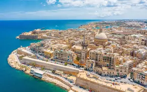
Malta is a tiny archipelago in the Mediterranean that has a colourful past and unrivalled natural beauty. From green rolling countryside to the coastlines, there is surely something for every intrepid hiker.
Disclaimer — We may earn a commission if you book via certain links on the website. No extra cost to you.
If you are an avid hiker who’s looking to spend a weekend hiking through Malta. Before you book one of the Airbnb vacation rentals in Valleta, Malta that you’ve been eyeing, here are some of the best routes to check out in this tiny archipelago.

The Best Hiking Trails in Malta
the victoria lines
First up is the Victoria Lines. This stretch of fortified rock walls was built by the British back in 1897. The 7.5-mile long walk follows the walls closely which runs east to west in the northern part of the main Island. The walls itself snakes around the island’s terrain hugging a geological feature called the Great Fault. Because of this, there are many elevation changes during the entire walk but nothing too steep.
Because of the island’s size, the landscape also changes quite frequently along the way. Hikers can expect to be in a village one minute then be on open fields the next before ascending another hill. The walk is also a very scenic route giving you the best of what Malta can offer. It’s best to wear comfortable hiking shoes to make navigating these constant elevation changes easier.
comino island
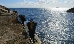
Comino Island is one of Malta’s two sister islands. This 1.3 square miles island is the smallest and the least populated out of the three. The island’s most prominent feature is the Blue Lagoon. A small inlet that is known for its strikingly blue waters popular among snorkelers and divers. The island itself only has 4 permanent residents and only one seasonal hotel.
The island’s hiking trail is a 4-miles walk that circles the whole island. It starts and ends at Blue Lagoon where the boats usually dock. Comino offers peace and quiet at its finest. Here you get to enjoy the beauty of nature and the sea without the crowds, unlike other popular sites. Visitors are free to explore the island in its entirety and experience the tranquil island ambiance in this part of the Mediterranean.

West Coast Walk
Next up is a quite challenging yet scenic route in Gozo, Malta’s second-largest sister island. As the name suggests, the West Coast Walk covers the west side of the island facing the Mediterranean. The trail is about 2.8 miles that takes you from the low-lying San Raflu Lake towards the coastal cliffs of western Gozo.
The first stop is the Wardija Punic Temple. The next notable landmark is located about 1.5 miles up north. The Dwejra Tower is one of the many ancient forts that dot the landscape. This one, however, is open to hikers. You can climb up to the top and see the surrounding landscape including Dwejra Bay. Then just a short walk up north is the famous Azure Window (collapsed in March 2017). The once iconic limestone arch featured in the TV series Game of Thrones.
ramla bay Gozo
Another great route in Gozo is the Ramla Bay trail. This 8-mile trail takes you through the fertile low-lying valley on the northern side of the island. Some of the notable places throughout the walk include the historic village of Xagħra. The village sits on a hill overlooking the bay. An agricultural community that still practices traditional farming to this day.
Along the way, hikers can also encounter remnants of Malta’s past. The Ġgantija Temples is a UNESCO World Heritage Site and is one of the oldest archeological sites in Malta. Another notable historic landmark is the Ta-Kola Windmill. A structure that dates all the way back to the Medieval Ages. Finally, we get to the bay itself. The Ramla Il-Hamra beach is striking even from afar because of its bright red sands, giving it an otherworldly look.
watch towers walk
For history buffs who want to learn a ton of Maltese history while enjoying Malta’s northern coast, there is the Watch Tower Walk. This 9-mile walk begins at the Ghadira Bay near the Ghadira Nature Reserve. Then, hikers head north until they reach the historic Red Tower—an iconic fort built in the 1600s. The fort saw action for much of its life until as recently as WWII.
After this, the trail then heads to the east, closely following the coastline. Along the way, you get to see a few structures and a bit of pastoral Malta before looping back to the Red Tower. Some of these structures include a WWII-era outpost named Ta' l-Imgħarqa and a much older structure called Aħrax Tower. During clear days, you can spot the Santa Marija Battery Tower at Comino across the water.

Tas-Silġ Walk
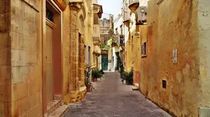
For hikers who want a more leisurely walk with not much of a challenge but with amazing views. Tas-Silġ Walk is a trail that connects the two villages of Marsaskala and Marsaxlokk at the Southeastern part of Malta. This easy trek starts at Marsaskala parish church by the sea. Then you head westward, navigating through Marsaskala’s streets. The village itself is a great place to explore especially if you are into laid-back and cozy villages.
Midway, the path splits into two separate paths. The first route takes you inland through the greener countryside. The second route, on the other hand, follows the coastal cliffs. Both routes lead to Marsaxlokk and there is no big difference from the two except the sceneries. At Marsaxlokk, reward yourself with a good drink and the warm hospitality of the people.
dingli cliffs
Finally, no visit to Malta is complete without making a pilgrimage to Dingli Cliffs. The cliff is an impressive wall of limestone overlooking the west coast of the island. The cliffs start near Dingli Village slowly rising from the coast until it reaches 253 meters (830 feet) above sea level.
From the village, the cliffs then stretch 2 kilometers (0.77miles) towards Mungar. At the highest point sits the solitary St. Mary’s Chapel. This 17th-century chapel fondly named “chapel of the cliffs” by the locals. Before you go, keep in mind that the terrain is mostly unlevel ground, mainly limestone.

🏨 Find the Best Places to Stay Nearby
This fantastic interactive map below helps you discover the best accommodation across the island from a variety of trusted platforms. Explore different areas, compare prices, and book directly, all in one place.
Other Related Pages That Might Interest You
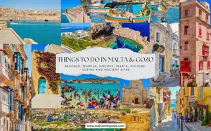
10+ Top Things to Do in Malta | Your Ultimate Travel Guide
Explore the best of Malta with our curated guide to the top things to do on the island. Get a taste of what you can do for an unforgettable trip.
How Many Days In Malta? | Summary Of Spending 1 to 7 Days
See how many days in Malta is worth staying. A summary of spending between 1 to 7 days in Malta and suggestions on how to split your holiday on the islands.
Gozo What To Do? | Top 10 Things To See and Do
Check out our top 10 things to do and see on the island of Gozo. It's hard where to begin. Read our Gozo what to do suggestions.


🚗 Need a car for your Trip to Malta?
Discovering the beauty of this gem in the Mediterranean by car is certainly the best way to experience its hidden beaches, charming villages, and difficult-to-reach paths that are hard to reach by public transport.
Find The Best Rates On Your Car Rental Now!

Disclaimer — We may earn a commission if you book via certain links on the website. No extra cost to you.

🎉 What’s On In Malta?
Updated for May • Local picks
Discover events, village feasts, fireworks, festivals and seasonal things to do this May.
📅 See What’s Happening This May ⛪ Malta Village Feasts 🌞 Things To Do In Malta 🗓️ Events By MonthTop Things To Do
- 3 Days In Malta
- Best Hiking Trails In Malta
- Blue Grotto Malta
- Blue Grotto Restaurants
- Fun Things For Kids in Malta
- Top Tourist Attractions In Malta
- Malta Bucket List
- Top 10 Things to do in Malta
- Top 10 Things to do in Gozo
- Top 20+ Things to do in Valletta
- Malta Scuba Diving
- Malta Romantic Vacations
- Um El Faroud
✈️ Planning your Malta trip?
✈️ Flights to Malta
Compare airlines and find the best prices today.
Check today’s cheapest flights →🏨 Hotels in Malta
Find available rooms, trusted stays and good locations for your Malta trip.
See available hotels this week →🚗 Car Rental in Malta
Compare prices, pick-up points and car options before you book.
Compare car rental prices →Planning London too?
Discover where to stay, what to do, and when to visit London.
Explore London Guide →Recent Articles
-
Summer Carnival Malta 2026 | Il-Karnival Tas-Sajf Guide
May 19, 26 02:34 PM
Summer Carnival Malta 2026 brings floats, costumes and music to Malta’s summer nights. See dates, tips, transport, nearby places and FAQs. -
Malta International Wine Festival 2026: Wine in Floriana
May 19, 26 01:13 PM
Malta International Wine Festival 2026 brings wine tasting, food, music and summer atmosphere to Argotti Gardens in Floriana. -
Dance Festival Malta 2026: Dates, Tickets & Visitor Guide
May 19, 26 01:06 PM
Dance Festival Malta 2026 brings contemporary dance, workshops and performances to Valletta. See dates, tickets, venues and visitor tips.